
Trace Winston-Salem Street Records
A by-address search works best as a short chain, not as a claim about who is presently inside a building. Start with the official or situs address in the county property tools. That result can provide the parcel and owner or taxpayer context. Use the parcel identifiers to locate the recorded deed, then read the instrument and plat for the legal description. The voter route and older address directories are separate, dated sources. They can add context when lawfully available, but should not be treated as a street roster.
- Enter the address in the Forsyth Tax Property Search and record the tax year, official address, parcel or PIN, REID, and each address label shown.
- Use the same official address in MapForsyth to check nearby parcel geometry and the map-linked property information.
- Search Forsyth Deeds for the recorded parties, then follow the book, page, instrument, and plat references backward.
- For a dated civic-record lead, use the North Carolina voter lookup by name and county, or ask the Board of Elections about the lawful list route. The ordinary lookup is name based, not a street browse tool.
- For older address evidence, consult a criss-cross or city-directory source through the local history collections, keeping the publication year beside every result.
Each step answers a narrower question. A tax owner can differ from the recorded owner, a deed party can be a trustee or prior owner, and a directory entry is tied to its publication date. That distinction is what makes a Winston-Salem street directory search more reliable.
Winston-Salem Street Directory Sources
Forsyth keeps address-keyed material in several systems. The useful record is determined by the question: parcel context, legal transfer, municipal activity, electoral status, historic setting, or postal formatting. None of the rows below is a complete occupancy list. Together, they create a careful street-by-street research trail.
| Address record | Local keeper | Street-level value | Access route |
|---|---|---|---|
| Tax assessment card | Forsyth Tax Department | Tax owner or taxpayer, REID/PIN, situs and mailing fields, value context | Public property portal, property details, or office request |
| Parcel GIS | Forsyth GIS / MapForsyth | Official address, parcel shape, REID, layers, adjacent parcels | Public map viewer; not a survey |
| Recorded deed or plat | Forsyth Register of Deeds | Recorded parties, dates, legal description, lot and easement context | Forsyth Deeds, office, or archive |
| Permit or code case | City-County Inspections / Accela | Address, case or permit type, status, and dated activity where public | BuildIT guest route or Accela search |
| Voter record | Forsyth Board of Elections | Statutory registration and election geography where not protected | Name lookup or lawful written-list request |
The property and map tools share identifiers, while the deed index supplies the recorded transfer context. The City-County Inspections and Accela routes are keyed to address activity, not residence. USPS then validates a delivery format without identifying a person.
Search Winston-Salem Parcels Precisely
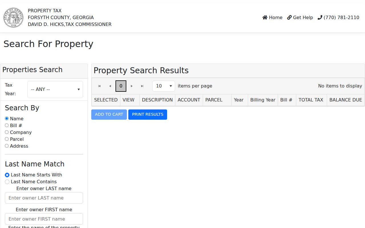
The observed assuranceGov form provides a clear starting point when an address is known. It first exposes a tax-year selector, then Search By choices for Name, Bill Number, Company, Parcel, and Address. A name search also offers Starts With and Contains controls, an owner last name, and an optional first name. Use the address route for a street question and save the visible tax year with the result.
| Forsyth control | Input | How it narrows a street search |
|---|---|---|
| Tax Year | Selector | Identifies the assessment snapshot |
| Search By | Name, Bill #, Company, Parcel, or Address | Chooses the known identifier |
| Last Name Match | Starts With or Contains | Controls the owner-name match |
| Owner Last Name | Text | Supplies a tax-owner lead |
| Owner First Name | Optional text | Helps separate similar names |
The tax card may show both a mailing address and a situs address. Label them exactly as displayed. A mailing address can be elsewhere, and an assessment entry is not a certified deed, boundary survey, or proof of current occupancy.
Note: The county lists property search, map archives, and property-record-card routes through its Tax Department.
Browse Winston-Salem Streets in MapForsyth
MapForsyth is the local bridge between an address and a run of nearby parcels. Its help material documents searches by owner name, parcel number, REID, official address, and block and lot. Partial owner and parcel searches are allowed. For a street form that does not match, the guide permits the percent sign as a wildcard and advises trying the street type omitted or abbreviated.
After a result appears, the viewer can show layers, imagery change over time, a table, statistics, map printing, drawing, and a buffer around a selected shape. Click features individually when they overlap. The map is especially useful for moving from one parcel to the next along a street, but the visual line is only navigation evidence. The county directs users to deeds, plats, and a licensed survey for legal boundaries.
MapForsyth's Tax Parcel Viewer guide documents the available tools and fields. Feature actions can export a CSV or table result, with exports limited to 1,000 records per action. That cap is a reason to keep a street inquiry narrow and source-focused.
Follow Winston-Salem Deed Chains
A parcel search becomes a title-research lead only after the recorded instruments are checked. The Forsyth Deeds index displays fields including party name, grantor or grantee role, date, code-book-page, document type, description, status, cross-reference, and image links. Search both sides of a transfer. A grantor, grantee, lender, trustee, estate, or entity is a recorded role, not a conclusion about present residence.
Use the newest deed first, then follow the cited book, page, and prior references. A plat may add the lot, block, subdivision, street, easements, or rights-of-way that the street address alone cannot supply. Uncertified real-estate copies were listed at 25 cents per page; older material or a missing image may require an office or archive visit. The Register of Deeds is at the civic center and keeps the record schedule current.
The Forsyth Deeds search is the source for the index and available real-estate images. Its chronology explains why a chain can move among handwritten volumes, typed books, microfilm, and computerized indexes.
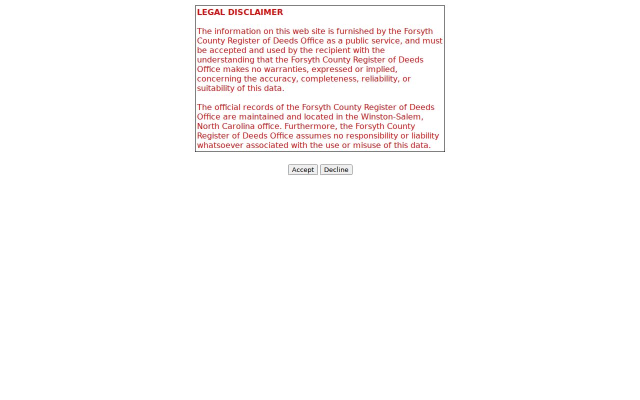
The recorded-party search is a starting point for the deed trail. Read the linked image and legal description before treating a book-and-page hit as a property conclusion.
Check Winston-Salem Address Activity
City-County Inspections is an address-specific source for building, electrical, mechanical, plumbing, and zoning-enforcement activity in its stated service area. Its electronic BuildIT portal has Contractor ID and Guest Access routes. The public interface may show a permit number, address, type, status, dates, inspection activity, and applicant or contractor fields, depending on the live guest view.
For code matters, the City says its Accela case search accepts address and case searching. A public case display can provide the location, type, date, status, and description, but it does not show the complainant. Do not infer who made a report from the address or case history. Permit and case records describe municipal activity, not everyone connected to a property.
Compare Winston-Salem Record Dates
Dates do much of the work in an address search. The tax portal describes an assessment snapshot, while the Register of Deeds records an instrument on its recording date. A permit or code entry records municipal activity at a particular time. A voter result and a directory entry have their own status or publication dates. Put those dates beside the address before deciding whether two records belong to the same period.
Forsyth's Register of Deeds reports instruments from 1849, official recording beginning in 1913, handwritten copies through 1904, typed copies from 1904 through 1929, microfilming from 1954, and computerized indexes from 1965. That history explains why one Winston-Salem street record may lead to a modern image while another leads to an older volume, index, microfilm, office, or archive route. A missing digital image is an access limitation, not proof that the record never existed.
For a street history, capture the source, date, recorded role, address or legal description, parcel identifier, and retrieval date. That modest record trail is more useful than combining unrelated results into a single claim.
Separate Winston-Salem Address Labels
Address labels are not interchangeable. An official or situs address identifies the parcel location in the tax and GIS environment. A mailing address is where correspondence is sent. A postal address is the form validated for delivery. A historical directory address is a dated publication entry. Preserve the original form first, then normalize only enough to search house number, street name, type, direction, unit, city, state, and ZIP.
- Parcel
- A defined piece of land in the tax and GIS system, usually connected to a parcel number or REID.
- Situs address
- The official location attached to the parcel, which may differ from a mailing field.
- Plat
- A recorded map that can show lot, block, subdivision, streets, easements, and rights-of-way.
- Criss-cross directory
- An address-organized directory used to find a dated listing by street rather than by surname.
For a disputed or newly assigned address, confirm the county GIS or tax record and applicable municipal information, then use USPS for delivery validation. A map label, parcel centroid, or ZIP does not create an official address by itself.
Read Winston-Salem Street History
Historic research needs a date and a place-name check. Salem, Winston, Wachovia, and Winston-Salem can all appear in older records, and the 1913 consolidation can explain a missed modern-name search. Old directories, deed descriptions, plats, and historic maps help reconcile an earlier street label or number with present parcel geography. The sources should be compared rather than forced to agree.
The Library of Congress Sanborn collection includes Winston-Salem sheets from 1917 through November 1950, plus related sets from 1885, 1890, 1895, 1900, and 1907. These maps show building footprint, construction, use, and street context. They are not lists of people. Note the sheet, date, volume, and page when using one beside a deed or directory entry.
The Forsyth assessor search form shows the address, parcel, owner, bill, and company routes used before moving to the deed index or map.
The Sanborn date range offers a useful comparison layer for street research. It can reveal built context around an address while the property and recorded-instrument tools supply the parcel and legal record trail.
Limit Winston-Salem Street Exports
The MapForsyth viewer can create a table, statistics, CSV output, or mailing-label PDF from selected features or a drawn shape. The guide limits CSV output to 1,000 records per action and label PDFs to 30 labels per page. Those functions can help review a small, legitimate parcel set, yet they are not a reason to build a broad address list or republish personal details.
Keep a short research log instead: source, record date, name and recorded role, address or legal description, identifier, access limit, and retrieval date. This makes a tax snapshot distinguishable from a recorded deed or historical directory. It also makes later corrections possible without turning a street directory into an unsupported claim about a person.
Note: Map layers and property cards change over time, so retain the tax year and retrieval date with every Winston-Salem address result.
Respect Winston-Salem Street Limits
A Winston-Salem street directory can locate public property and municipal records, not create a complete list of people at an address. Utility customer data and motor-vehicle address information are not a public street roster. A missing address in a voter result is not evidence that someone does not live in the county. It can reflect the source's scope, status, date, or a lawful protection.
Lawful personal use. North Carolina's Address Confidentiality Program can shield an eligible participant's actual property address, and protected voter addresses must not be reconstructed. Use records for a legitimate personal purpose, minimize unnecessary details, and never use address information to stalk, harass, or intimidate another person.
North Carolina Chapter 15C establishes the Address Confidentiality Program. It is a protection to respect, not an obstacle to work around.